
19 June, 07 – 13.53 GMT
17.1218N,61.4120W
Continued from the previous page.
It was very tough trying to row the boat in an adverse SE side wind. 80% of the boat is out of the water, so its very sensitive to wind direction.
Photo 1: CLEARER AND CLEARER: One of those moments - watching trees and grass appear after 3 months of blue sky and water.
Photo 2: BUILDINGS: The tower like structure visible is that of an abandoned sugar cane processing mill on the island. Steering for Military Camp Blizzard
Photo 3: TURNING THE BOW: Trying to make it to channel markers. Fighting to turn the bow towards the white building (Marina at Military Camp Blizzard). Broken rudder visible at the stern. Its come off the last bit of lashing. The dark patches of water, seen in this photo is the corral reef. A few inches below the surface.
I was a little stressed. The wind was blowing the boat sideways onto the reef. It's very difficult to see where the boat is going while seated in a rowing position because the back is turned towards the front. (Hard to believe I've traveled backwards for 3000 miles across the Atlantic and had problems 500 ft from land).
People swimming on the beach looking on. Quite a show.
(For assistance with co-ordinating my arrival, many thanks to Maurice Merchant - Office of the Prime Minister, Antigua and; Barbuda, Jonathan - ABSAR,HeadofChancery, Guyana and; Embassy, Sweden, A.Kelkar, S. Ambani, V. Tewani, Captain Nicholas, Commanding Officer, Antigua and; Barbuda Coast Guard. Photos taken by Ted Martin, Antigua.)
My contacts in Antigua:
OR at the Antigua Yacht Club Marina and; Resort
http://www.aycmarina.com/
Land: +1268 460 1544 , Room 25.
Mobile: +1268 772 9605.
(or + 268 772 9605 from the US)
mail@bhavik.com
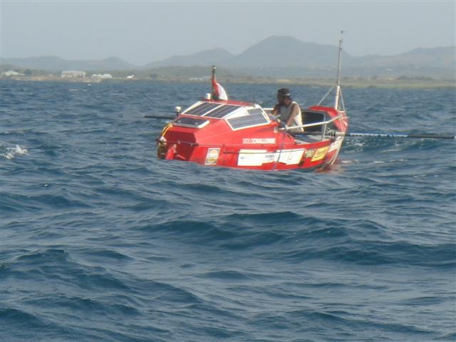
Photo 1:Click to enlarge
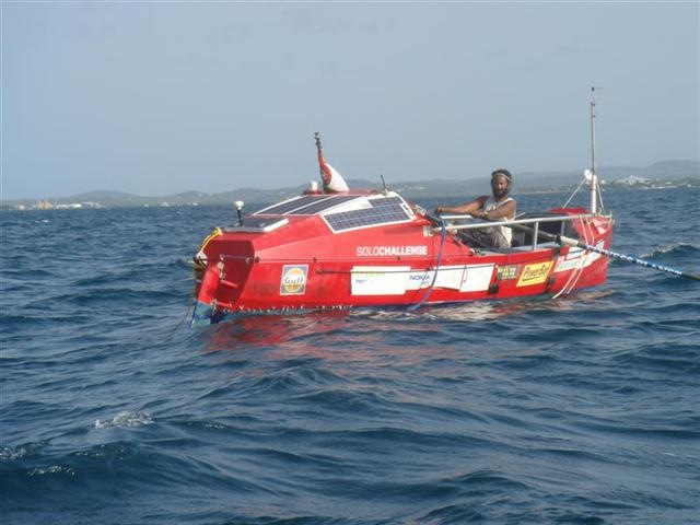
Photo 2:Click to enlarge
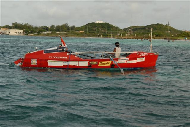
Photo 3:Click to enlarge
No comments:
Post a Comment