
14 June, 07 – 07.17 GMT
17.1203N,61.3205W
Distance left: 17.4 Nautical Miles
Posted at 03.17 hrs Local Time, Antigua on 14th June.
18.17 hrs Sydney, 13.47 hrs IST, 07.17hrs GMT,
Good morning!
I can see a faint yellow glow across the horizon to the West! I believe its the lights of Antigua being reflected by the clouds. The land is not yet visible, but the feeling of spotting the glow is indescribable.
Its 02.17 am here and I've been rowing in the pitch darkness for the past 8 hours trying to make my way further South West. I'm trying hard to avoid a tow in and complete my row from Land (Marina La Restinga, El Hierro to Land (English Harbour, Antigua), although I have officially completed my Atlantic crossing (at the longitude of Barbados).
Weather conditions have been tough and I now expect land fall within 8 hours.
New ETA: 12.00 Noon Antigua, 16.00 hrs GMT, 21.30 hrs IST, 04.00 Sydney
---------------------------------------------------
I should have been on land by now, however, since last evenings posting at 21.15 GMT last evening (13th June) I had a change of plans here is a re-cap of events.
On JUNE 13 @ 15.30 GMT, 33 NM away:
I posted on here (read Day 105 – POST 1: Challenges of Keeping Course, Weather Forecast) that
I was being pushed off course, to the North of Antigua, by a strong wind from the South East. I stated that I would try and make my way South West, rowing parallel to the waves.
@ 19.30 GMT, 29 NM away:
The sea state worsened. The wave height increased dramatically to around 8-10 ft and the wind speed increased to about 20 knots. I'm guessing that the sudden increase in wave height was due to the ocean floor rapidly rising, thus pushing the water upwards. It was getting dangerous to row parallel to the waves and it was difficult to make any further progress South West as originally planned. Very disappointing progress wise.
@ 20.00 GMT, 26 NM away:
The Office of the Prime Minister and ABSAR were standing by to provide me with a ceremonial escort from the time I entered Antigua waters until the distance to English Harbour. I contacted them Via Satellite phone and stated that it was difficult to make progress S and if the could extend the escort to 12 miles out of Antigua waters, it would really help.
@ 21.00 GMT, 25 NM away:
I received confirmation that the boat was on its way to tow me into port.
@ 21.30 GMT, 25 NM away:
I received clarification from land that a 65 ft coast guard boat was being specially dispatched to tow me in. (This was different from the official boat).
@ 21.45 GMT, 25 NM away:
I contacted the Coast Guard to request them to cancel the dispatch. It was not an emergency and I did not want to tie up rescue resources in case they were needed elseware on a real emergency. I decided to have another shot at rowing into port one more time under my own power.
---------------------------------------------------
So, I am still out at sea trying to make it into port under my own power. The sea state is rough. Far more that I had imagined. I'm 17 miles off shore making very slow progress forwards. Its dark and a little stressed about the reefs in the dark. I've got charts however. 3 hrs more till daylight.
I plan to row a bit more and then drop anchor till conditions improve.
Will post an update here in the next 3 hours.
Right now, just very excited to see the lights of Antigua!
B
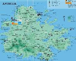
Antigua
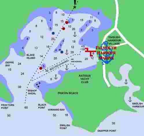
Nelsons Docyard / English Harbour Map
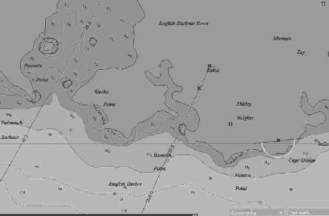
CMAP Data English Harbour
No comments:
Post a Comment