Tuesday, June 19, 2007

PART 10: Landfall Photos - Miss Olive resting

19 June, 07 – 14.39 GMT    
Continued from the previous page.

md-070614_37beach
Photo 1: MISS OLIVE resting on Jabberwaki Beach

md-070614_38beach
Photo 2: MISS OLIVE resting on Jabberwaki Beach

md-070614_39rudder
Photo 3: WALKING AWAY: with the rudder in the hand. Miss Olive being towed away (background) to Camp Blizzard Military Base.

md-079999_darkwoodbeach
Darkwood beach, Antigua

md-079999_cg
Coconut Grove beach, Dickinson Bay, Antigua

md-079999_adf
Antigua Defence Force, Chief Of Staff & Comanding Officer, Coastguard

(For assistance with co-ordinating my arrival, many thanks to Maurice Merchant - Office of the Prime Minister, Antigua and; Barbuda, Jonathan - ABSAR,HeadofChancery, Guyana and; Embassy, Sweden, Captain Nicholas, Commanding Officer, Antigua and; Barbuda Coast Guard. Photos taken by Ted Martin, Antigua.)

My contacts in Antigua:
OR at the Antigua Yacht Club Marina and; Resort
http://www.aycmarina.com/
Land: +1268 460 1544 , Room 25.
Mobile: +1268 772 9605.
(or + 268 772 9605 from the US)
mail@bhavik.com


My news updates will resume at www.bhavik.com.
Thanks to everyone for the support and following my Atlantic row.

PART 9: Landfall Photos - People and; Press

19 June, 07 – 14.39 GMT    
17.1218N,61.4120W

Continued from the previous page.

md-070614_35rudder
Photo 1: WITH JONATHAN FROM ABSAR (Antigua Barbuda Search And Rescue) and the broken rudder.

md-070614_36beach
Photo 2: MISS OLIVE on Jabberwaki Beach

md-070614_40odometer
Photo 3: TRIP ODOMETER: Stands at 3456 nautical miles

PART 8: Landfall Photos - People and; Press

19 June, 07 – 14.38 GMT    
17.1218N,61.4120W

Continued from the previous page.

md-070614_32ques
Photo 1: PRESS

md-070614_33int
Photo 2: PRESS

md-070614_34ind
Photo 3: PEOPLE

PART 7: Landfall Photos - People and; Press

19 June, 07 – 14.38 GMT    
17.1218N,61.4120W

Continued from the previous page.

md-070614_29army
Photo 1: ARMED FORCES: Army Chief and personnel at Military Camp Blizzard, where my boat is presently moored.

md-070614_30int
Photo 2: INTERVIEW FOR TV

md-070614_31ques
Photo 3: PRESS

PART 6: Landfall Photos - People

19 June, 07 – 14.37 GMT    
17.1218N,61.4120W

Continued from the previous page.

md-070614_26maurice
Photo 1: A CLEAN TSHIRT: I'd used all the clothes on board to soaking up water from the leak. A special thanks, Maurice Merchant from the Prime Ministers office for bringing a clean shirt along for me :)

md-070614_27winstonwilliams
Photo 2: MINISTER OF TOURISM

md-070614_28maurice
Photo 3: A BOOK GIFTED BY THE PRIME MINISTER

PART 5: Landfall Photos - 17.36 GMT

19 June, 07 – 14.36 GMT    
17.1218N,61.4120W


Continued from the previous page.

md-070614_23land1736gmt
Photo 1: ONE FOOT ON: Photo taken by Ted Martin at 17.36 GMT. 106 days, 09 hrs, 30 mins. 6393 kms (3456 nautical miles) from El Hierro, Canary Islands.

md-070614_24greetings
Photo 2: ITS OVER.

md-070614_25sportsmin
Photo 3: MINISTER OF SPORTS: Winston Williams
(For assistance with co-ordinating my arrival, many thanks to Maurice Merchant - Office of the Prime Minister, Antigua and; Barbuda, Jonathan - ABSAR,HeadofChancery, Guyana and; Embassy, Sweden, A.Kelkar, S. Ambani, V. Tewani, Captain Nicholas, Commanding Officer, Antigua and; Barbuda Coast Guard. Photos taken by Ted Martin, Antigua.)
My contacts in Antigua:
OR at the Antigua Yacht Club Marina and; Resort
http://www.aycmarina.com/
Land: +1268 460 1544 , Room 25.
Mobile: +1268 772 9605.
(or + 268 772 9605 from the US)
mail@bhavik.com

PART 4: Landfall Photos - Off the reef, Onto beach

19 June, 07 – 14.35 GMT    
17.1218N,61.4120W

Continued from the previous page.

md-070614_20wind
Photo 1: OFF THE REEF: Pulling on just the starboard oar to turn it away from other rocks.

md-070614_21jabbawock
Photo 2: JABBERWOCK BEACH: Finally got the boat off the reef and towards a patch of beautiful white sand inbetween the corral reef.

md-070614_22Jonmd-athanAbsar
Photo 3: TOUCHDOWN: Hard to stand up. Hurting from stomach cramps from working just one side of the body to escape the reef. Trying to walk. Jonathan from ABSAR - welcomes me on shore.
(For assistance with co-ordinating my arrival, many thanks to Maurice Merchant - Office of the Prime Minister, Antigua and; Barbuda, Jonathan - ABSAR,HeadofChancery, Guyana and; Embassy, Sweden, A.Kelkar, S. Ambani, V. Tewani, Captain Nicholas, Commanding Officer, Antigua and; Barbuda Coast Guard. Photos taken by Ted Martin, Antigua.)
My contacts in Antigua:
OR at the Antigua Yacht Club Marina and; Resort
http://www.aycmarina.com/
Land: +1268 460 1544 , Room 25.
Mobile: +1268 772 9605.
(or + 268 772 9605 from the US)
mail@bhavik.com

PART 3: Landfall Photos - W.W.R.D.D?

19 June, 07 – 14.19 GMT    
17.1218N,61.4120W


Continued from the previous page.
Photo 1: TRYING TO STAY OFF: I finally turned the bow around, working just one oar with both hands. Desperatly trying to steer it away from the reef. My hands clawed up and had severe stomach cramps. With every second, the wind pushed the boat further onto the reef.
Photo 2: HIT THE REEF: A lot of conflicting directions from the coastguard and the photographers on the location of the corral underneath. I could not see the corral as my back was towards the front, trying to row away. The bottom of the boat finally struck the reef.
Photo 3: TRYING TO ROW OFF: An officer from the coast guard jumped and started swimming towards the boat to help with getting it off the reef. Unfortunately he got into trouble in the water and had to be rescued (not shown here). Trying to push the boat off the reef with the oar and row onto the beach in instead (Plan C) of the pier at Military Camp Blizzard. Photographers, Press and TV taking photos of me stuck on the reef and the coast guard trying to save the coast guard.
What Would Robert De Nero Do?
(For assistance with co-ordinating my arrival, many thanks to Maurice Merchant - Office of the Prime Minister, Antigua and; Barbuda, Jonathan - ABSAR,HeadofChancery, Guyana and; Embassy, Sweden, A.Kelkar, S. Ambani, V. Tewani, Captain Nicholas, Commanding Officer, Antigua and; Barbuda Coast Guard. Photos taken by Ted Martin, Antigua.)
My contacts in Antigua:
OR at the Antigua Yacht Club Marina and; Resort
http://www.aycmarina.com/
Land: +1268 460 1544 , Room 25.
Mobile: +1268 772 9605.
(or + 268 772 9605 from the US)
mail@bhavik.com

md-070614_17reef

md-070614_18reef

md-070614_19reef

PART 2: Landfall Photos - steering past reef

19 June, 07 – 13.53 GMT    
17.1218N,61.4120W


Continued from the previous page.
It was very tough trying to row the boat in an adverse SE side wind. 80% of the boat is out of the water, so its very sensitive to wind direction.
Photo 1: CLEARER AND CLEARER: One of those moments - watching trees and grass appear after 3 months of blue sky and water.
Photo 2: BUILDINGS: The tower like structure visible is that of an abandoned sugar cane processing mill on the island. Steering for Military Camp Blizzard
Photo 3: TURNING THE BOW: Trying to make it to channel markers. Fighting to turn the bow towards the white building (Marina at Military Camp Blizzard). Broken rudder visible at the stern. Its come off the last bit of lashing. The dark patches of water, seen in this photo is the corral reef. A few inches below the surface.
I was a little stressed. The wind was blowing the boat sideways onto the reef. It's very difficult to see where the boat is going while seated in a rowing position because the back is turned towards the front. (Hard to believe I've traveled backwards for 3000 miles across the Atlantic and had problems 500 ft from land).
People swimming on the beach looking on. Quite a show.
(For assistance with co-ordinating my arrival, many thanks to Maurice Merchant - Office of the Prime Minister, Antigua and; Barbuda, Jonathan - ABSAR,HeadofChancery, Guyana and; Embassy, Sweden, A.Kelkar, S. Ambani, V. Tewani, Captain Nicholas, Commanding Officer, Antigua and; Barbuda Coast Guard. Photos taken by Ted Martin, Antigua.)
My contacts in Antigua:
OR at the Antigua Yacht Club Marina and; Resort
http://www.aycmarina.com/
Land: +1268 460 1544 , Room 25.
Mobile: +1268 772 9605.
(or + 268 772 9605 from the US)
mail@bhavik.com

md-070614_14clearer

Photo 1:Click to enlarge

md_070614_2approach

Photo 2:Click to enlarge

md-070614_16reef

Photo 3:Click to enlarge

PART 1: Landfall Photos and; recap - in sight, change of port

19 June, 07 – 07.17 GMT    
17.1218N,61.4120W


Hello from English Harbour Antigua!
wow! It takes 1 month at sea to miss life on land. And just 1 day on land to miss life at sea.
I set foot no land at 5.36 pm local time, at Jabberwok beach, next to military camp Blizzard, on the North East tip of the island. The clock stood at 106 days, 9 hrs 30 minutes. The odometer on the GPS stood at 3456 nautical miles (6393 kms).
Very mixed emotions being back on land. I'm making wobbly but fast recovery from life at sea but also missing the peace and freedom. Getting used to walking and the sores are subsiding. Here is a quick re-cap of my arrival in Antigua.
A number of overwhelming moments during my last few hours at sea.
Rowing in the darkness and watching a dull red glowing cloud, reflecting the lights of Antigua, appear on the horizon. The appearence of the strobe light high on the hills of Antigua. Stressing about hitting the reefs in the dark. Slowing the boat down with the sea anchor. Waiting for day light watching the boat drift closer and closer to shore as it dragged anchor. The first radio contact with land in the dark, on VHF. Rain. Then sunrise in the moring revealing Antigua covered in low clouds. Rain again. Watching clouds drift over the island. Then drift off the hills again. Watching the tops of buildings appear. Then trees. Seeing the first humans - coast guard officers - that came to escort me in. Finally the white sand the overwhelming smell of smoke, trees, flowers and land. Trying to make it into camp Blizzard. Pushed onto the reef by the winds. Trying to steer away. Hitting the reef. Coast guard officer getting into trouble in the water. Rowing the boat off the reef. Rowing it onto the white sand beach. Touching ground.
PHOTOS ON THIS PAGE
The conditions were tough. The weather refused to play ball. I spent 7 hard hours in the afternoon sun trying to row due South in South East headwinds in an effort to row into English Harbour, completing my row from land to land. It was hot, humid. I was tired. thirsty. Each time I stopped to drink water, I'd watch the numbers on the GPS change as the wind pushed the boat towards the North costing me hard earned progress.
There is nothing worse that rowing the same piece of ocean twice.
After speaking over the radio with ABSAR, I finally changed strategy and set course for CampBlizzard, a military base on the North East tip.
(For assistance with co-ordinating my arrival, many thanks to Maurice Merchant - Office of the Prime Minister, Antigua and; Barbuda, Jonathan - ABSAR,HeadofChancery, Guyana and; Embassy, Sweden, A.Kelkar, S. Ambani, V. Tewani, Captain Nicholas, Commanding Officer, Antigua and; Barbuda Coast Guard)
My contacts in Antigua:
OR at the Antigua Yacht Club Marina and; Resort
http://www.aycmarina.com/
Land: +1268 460 1544 , Room 25.
Mobile: +1268 772 9605.
(or + 268 772 9605 from the US)
mail@bhavik.com

md-070614_10approach (Small)

Last few hrs rowing:Click to enlarge

md-070614_12app (Small)

Hot and humid. Rowing all afternoon against the wind:Click to enlarge

md-070614_13landbow (Small)

Antigua visible in a distance, over the bow:Click to enlarge

Thursday, June 14, 2007

The Atlantic Has Been Rowed!

14 June, 07 - 23:33    
17.1000N,61.4600W

At 17.45 Local TIme, I rowed the boat onto the beautiful white sandy beach of Antigua, at Jabberwaki Point.
My row from Land to Land is finally over.
I was receIved by the Prime Minister's Office, The Sports Minister, The Minister for Tourism and others from the community and military.
The boat is presently at Camp Blizzard Military Base. I had terrible wind conditions from the SE and after 10 hours of futile rowing trying to get to English Harbour and speaking to ABSAR, I changed my landfall point.
I've been sleeping for the past 18 hrs. Legs are recovering slowly but well. Strange to walk again.
Just got connected. I can be contacted at
Mobile: +1268 772 9605.
(or from some countries+ 268 772 9605 )
OR at the Antigua Yacht Club Marina and; Resort
+1268 460 1544 , Room 25.
email : mail@bhavik.com
Local time here is GMT +5 / IST + 11
Will post more on here shortly.
Bhavik

md-070614_1flag

Approaching land

md_070614_2approach

Approaching land

md_070614_3approach

Approaching land

Day 106 - ARRIVED!

June 14, 2007 17:45 Local Time 

   
BHAVIK ARRIVED AT JABBERWOCK BEACH, ANTIGUA AT 5:45 PM LOCAL TIME COMPLETING AN HISTORIC EXPEDITION TO BE THE FIRST ASIAN TO COMPLETE AN OCEAN ROWING EXPEDITION SOLO AND UNASSISTED LAND TO LAND.
HE WILL STAY IN ANTIGUA FOR A FEW WEEKS AND WILL UPDATE HIS CONTACT DETAILS SOON.

Day 106 – Land Ahead!

14 June, 07 – 12.34 GMT    
17.1275N,61.3575W

Note:
@ 12.34 GMT, 08.34 Local TIme Antigua (GMT +5) (IST +9.30)
Just a quick post.
Its been a long night. Very tired as I've been rowing all night. Rowing in the darkness and first seeing the clouds glow on the horizon, reflecting the light of Antigua will remain an unforgettable moment.
Soon after I could see the strobe lights of a lighthouse and a few lights on shore before the rain clouds appeared.
The weather right now is still a bit squally and low rain clouds are still over the island. It keeps appearing and disappearing from view. But at least it's there!
There is a strong SE wind and I'm a little stressed about being blown onto the rocks. The SE wind is also blowing me northwestwards. I'm currently at the North East tip of the island. So, I still have a struggle ahead trying to get into English Harbour on the South East tip. Over the next few hours, I will have to row across waves on a bearing of 180 degrees, due South and steer with the South East component of the wind into the harbour. I would like to get in by rowing and avoid a tow if possible. Land to Land.
Fortunately, I'm now also within Radio distance of shore and in touch with ABSAR.
Hope to touch land on about 5 hrs.
Very hungry. Very tired. Very happy to hit Antigua right on target...just as advertised two years ago.
B
PS. Will post from land shortly. Pls email your messages to mail@bhavik.com , my normal email, so I can reply. Pls do NOT message my satellite phone. I will have my normal mobile number posted on here shortly.

md-070614_1lastsunrise

Last sunrise at sea

md-070614_2bow

View ahead, Antigua hidden under the clouds

md-070614_3ahead

Land at last. Antigua appears.

Day 106 – UPDATE: THE LIGHTS OF ANTIGUA!

14 June, 07 – 07.17 GMT
17.1203N,61.3205W


Distance left: 17.4 Nautical Miles
Posted at 03.17 hrs Local Time, Antigua on 14th June.
18.17 hrs Sydney, 13.47 hrs IST, 07.17hrs GMT,
Good morning!
I can see a faint yellow glow across the horizon to the West! I believe its the lights of Antigua being reflected by the clouds. The land is not yet visible, but the feeling of spotting the glow is indescribable.
Its 02.17 am here and I've been rowing in the pitch darkness for the past 8 hours trying to make my way further South West. I'm trying hard to avoid a tow in and complete my row from Land (Marina La Restinga, El Hierro to Land (English Harbour, Antigua), although I have officially completed my Atlantic crossing (at the longitude of Barbados).
Weather conditions have been tough and I now expect land fall within 8 hours.
New ETA: 12.00 Noon Antigua, 16.00 hrs GMT, 21.30 hrs IST, 04.00 Sydney
---------------------------------------------------
I should have been on land by now, however, since last evenings posting at 21.15 GMT last evening (13th June) I had a change of plans here is a re-cap of events.
On JUNE 13 @ 15.30 GMT, 33 NM away:
I posted on here (read Day 105 – POST 1: Challenges of Keeping Course, Weather Forecast) that
I was being pushed off course, to the North of Antigua, by a strong wind from the South East. I stated that I would try and make my way South West, rowing parallel to the waves.
@ 19.30 GMT, 29 NM away:
The sea state worsened. The wave height increased dramatically to around 8-10 ft and the wind speed increased to about 20 knots. I'm guessing that the sudden increase in wave height was due to the ocean floor rapidly rising, thus pushing the water upwards. It was getting dangerous to row parallel to the waves and it was difficult to make any further progress South West as originally planned. Very disappointing progress wise.
@ 20.00 GMT, 26 NM away:
The Office of the Prime Minister and ABSAR were standing by to provide me with a ceremonial escort from the time I entered Antigua waters until the distance to English Harbour. I contacted them Via Satellite phone and stated that it was difficult to make progress S and if the could extend the escort to 12 miles out of Antigua waters, it would really help.
@ 21.00 GMT, 25 NM away:
I received confirmation that the boat was on its way to tow me into port.
@ 21.30 GMT, 25 NM away:
I received clarification from land that a 65 ft coast guard boat was being specially dispatched to tow me in. (This was different from the official boat).
@ 21.45 GMT, 25 NM away:
I contacted the Coast Guard to request them to cancel the dispatch. It was not an emergency and I did not want to tie up rescue resources in case they were needed elseware on a real emergency. I decided to have another shot at rowing into port one more time under my own power.
---------------------------------------------------
So, I am still out at sea trying to make it into port under my own power. The sea state is rough. Far more that I had imagined. I'm 17 miles off shore making very slow progress forwards. Its dark and a little stressed about the reefs in the dark. I've got charts however. 3 hrs more till daylight.
I plan to row a bit more and then drop anchor till conditions improve.
Will post an update here in the next 3 hours.
Right now, just very excited to see the lights of Antigua!
B

md-070614_1antigua

Antigua

md-070614_2marina

Nelsons Docyard / English Harbour Map

md-070613_1engharb

CMAP Data English Harbour

Wednesday, June 13, 2007

Day 105 – POST 2 : A LAST LETTER FROM SEA...

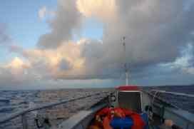
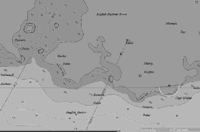
13 June, 07 – 21.15 GMT    
17.1646N,61.1885W


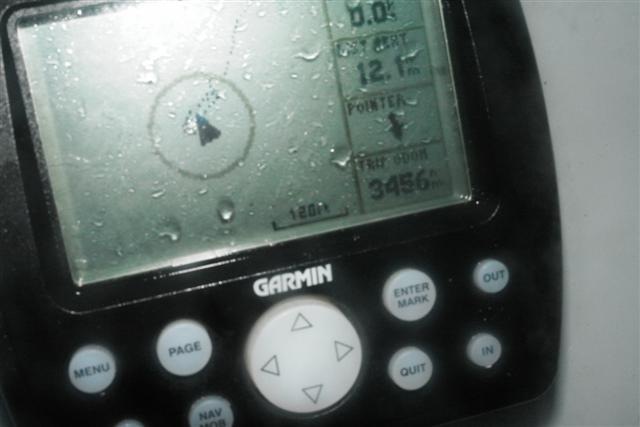
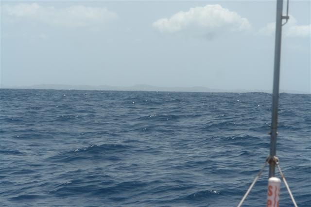
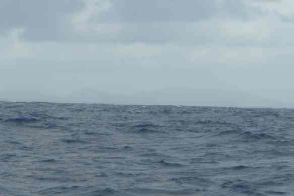
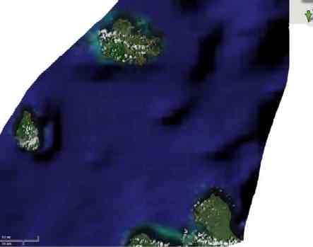
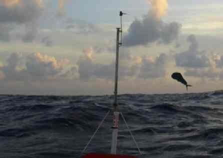
As I plot my progress on my Hydrographic / Topographic map of the North Atlantic Ocean, it's quite incredible to see the speed at which the numbers on the contours change 5645meters – 4680 – 3000 – 2000 and a sudden jump to 311 meters. I cannot see land as yet. My visibility to the horizon is limited to 5 miles as I am low off the water.
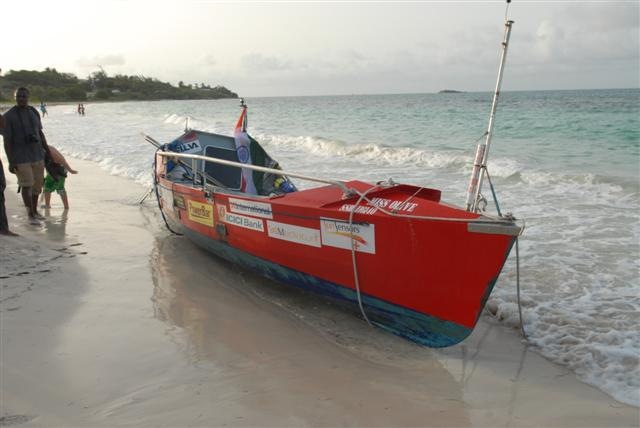
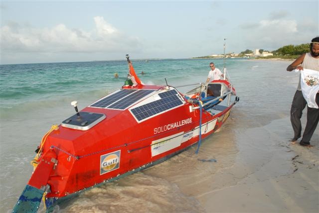
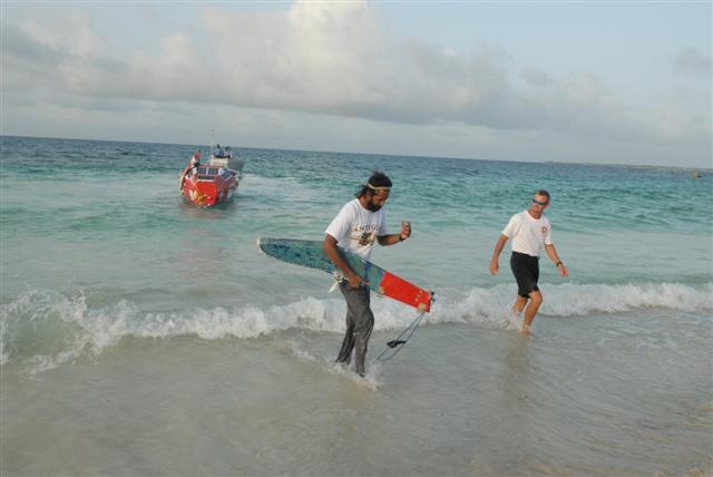
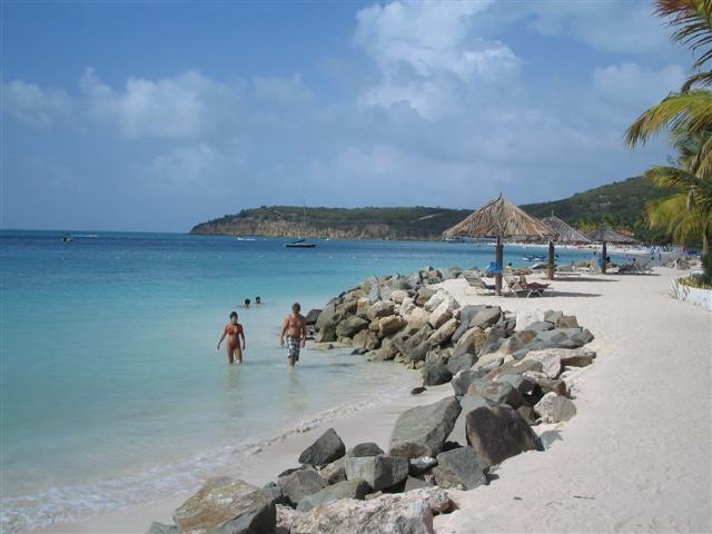
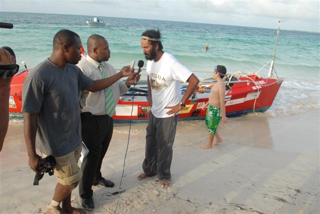
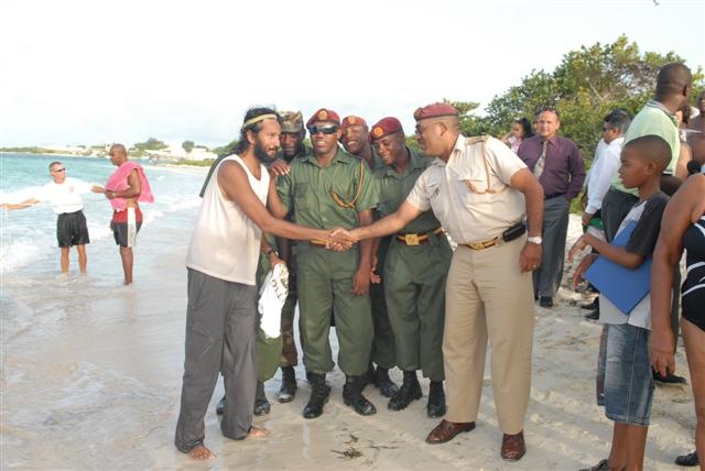
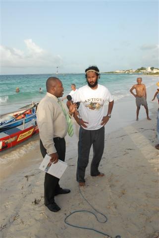
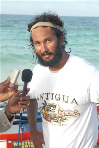
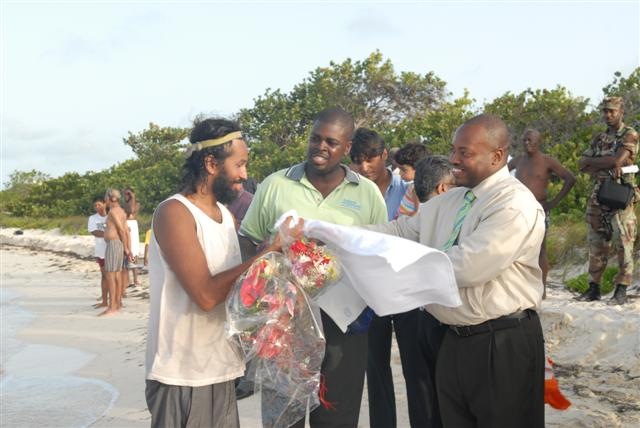
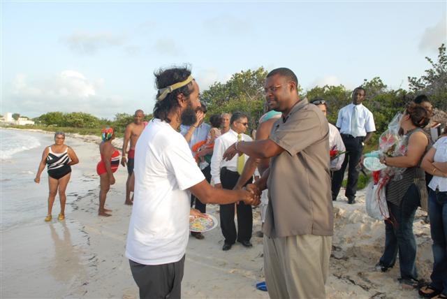
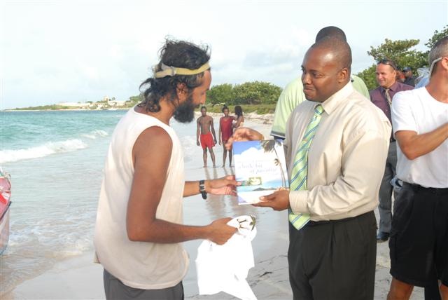
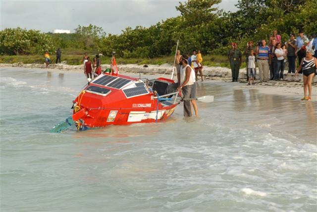
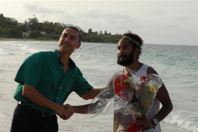
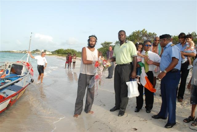
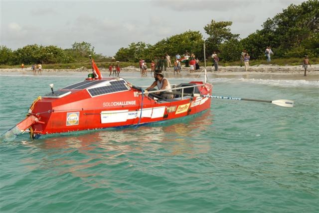
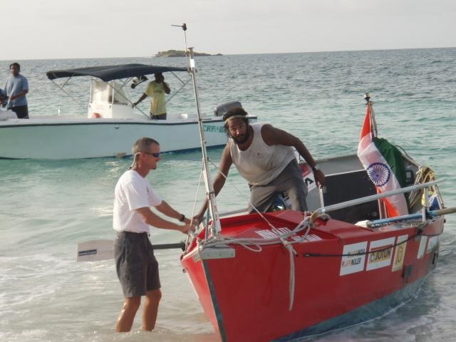
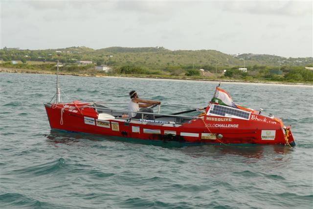
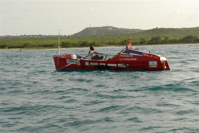
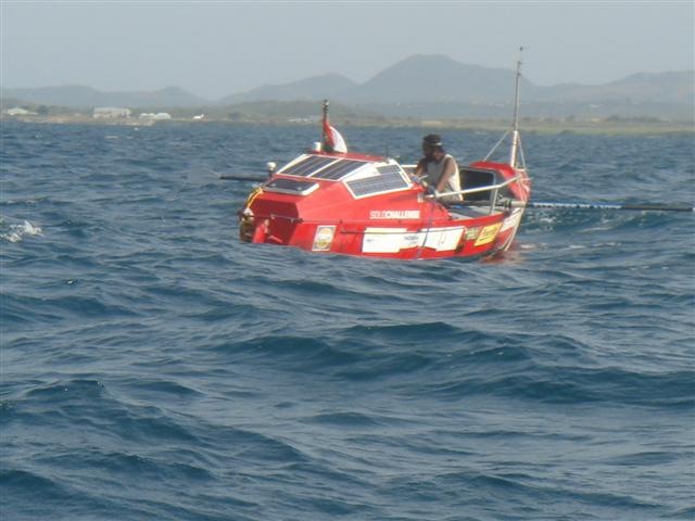
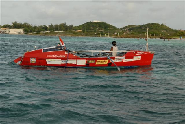
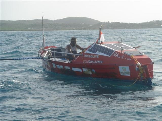
The Office of the Minister of Antigua has organized a welcome party and an official boat will shortly turn up to escort me into English Harbour....my row-eat-think lifestyle will soon be over.
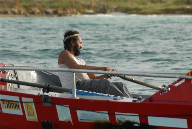
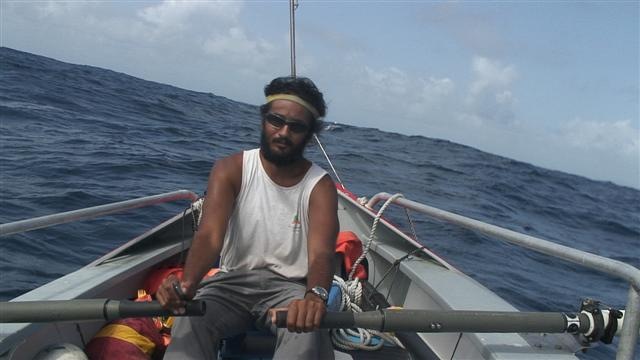
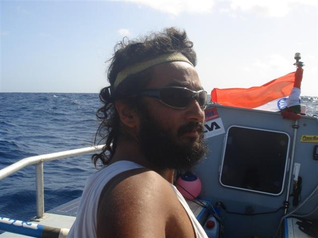
Life on a rowing boat is like living on a bucking bronco. The boat gets chucked about in the waves far more easily than a sail boat, so the number of cuts, bruises and bumps is well above average.
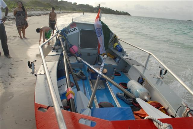
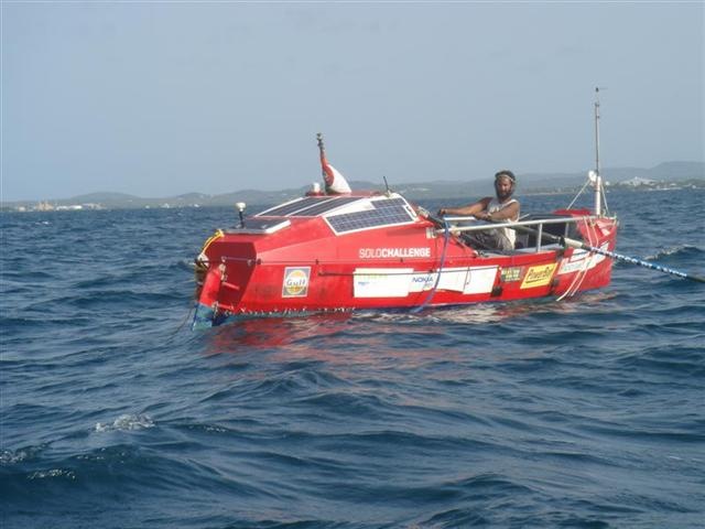
Apart from the physical discomfort of being constantly wet and not being able to sit upright in the small cabin, living on a 7 meters space for so long has other challenges.
It takes constant organizing to keep things in their place and it's messed up just as soon as the boat rolls violently from side to side. Then there is the endless task of charging batteries, backing-up data, putting things in and out of waterproof bags and digging through various hatches before you can find something.
Every little thing takes twice as long to do and needs advanced planning. Eating and drinking anything is done thru straws and lids and packets to make sure nothing spills. Sitting straight requires you to take into account the direction from which the waves are hitting the boat. Any trip out on deck requires sealing the hatch and putting on the harness routine. Pulling things in and out of watertight cases. Removing the mattress and everything on it, each time you need to access the storage compartments below. The only upside of it all is that it makes time on board pass much faster
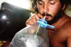
Take drinking coffee for instance. I mix the powder and cold water in a sports waterbottle that has a sip-lid on it to stop it from splashing in my eye when the boat rocks. Making it while rising and; falling, up and down at all sorts of angles is however is another story. I hold the open coffee bottle between my feet till I put the powder into the sports water bottle. Then hold the sports water bottle steady with my feet while I use my both hands to steady the 5 liter water bottle to add water to the coffee. Finally closing both open bottles of liquid quickly before they spill.
What gets you in the end though is not the large waves, constant wetness or salt sores or the routine. It's the small things that start to irritate. Like packaging for instance. Things that rust, spill or don't shut properly.
Technology is the worst offender. Chargers, inverters, cameras, laptop cables for cameras, laptops, cameras, card readers, hard disks satellite phone, voltage inverters all love to get entangled with each other. I just cleaned it up the day before and it's tangled again today. I'm the only one on board. Who is causing the mess?
But the advantage of such a small space is that if anything is not within arms reach, it will usually be within leg reach. Switches, radio, GPS, radar alarm, nav lights can all be operated with your toes. Even the ipod. However, it gets a little tricky if you're 6'3 like me. The head is too far from the toes to read the display properly.
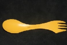
I find that I've come off with a much greater appreciation for intelligent design and functionality. With boat design, not an inch of space on board is wasted and everything can be used for more than one purpose. I've used a single item, an all-in-one spoon, fork and knife for every meal for the past 3 months (see pic). I think I will continue using it at home.
Apart from the things I've missed, I've also realized the things I can do without. The Internet and Google for instance. (Yes. I said it.) Back then, when I first found the water at the bottom of the boat, I could swear, for a nanosecond I thought of searching for the leak on Google. I've been off line now for 3 months and I don't really miss it.
So, how am I doing physically?
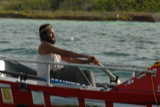
Well, my dentist used to tell me that I was very brave. She used to say that on a scale of 1 to 10 for pain (1 being minimum and 10 being maximum), what is a 9 for most people is a 1 for me. So going by her scale, I would say the salt sores on my rear feel like 81 out of 10!
Apart from nothing major. A lot of bruises, bumps and cuts and my skin and hair look like 6 miles of bad road. All will be fixed by the first hot shower. I'm not a big fan of medicine anyway. A while back I was flipping thru my medical handbook. I came across the first illness and it looked like I had the symptoms for that. So I turned the page to the next one and found I had some of the symptoms for that too. So I turned to the next one and recognized more of the symptoms. By the time I got to the end of the book, I had all the illness except two of them. Quite worrying. Why didn't I have these two?
So, I'd rather not know. In fact, with all this rowing business, I've never been fitter or healthier and I can hold my breath for 1 whole minute more than Marlboro man.
How am I doing Mentally ?
Very exhausted. In fact, more than physically. It's been quite draining to maintain course, avoid tankers, cope with isolation and stay motivated. On one hand, I am quite sad to finish this journey but I am also looking forward to sleeping on a bed that I don't have to keep on course all the time.
It's been very motivating to receive messages of encouragement from everybody all along the trip. But now, all 1 billion of you can relax stop messaging me to go on. Not much of a choice left now :)
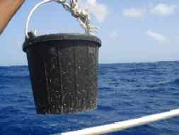
You will be amazed how many messages I have been getting from all around the world about one thing - the toilet!
Since it's my last post, I will finally break the suspense. Are you ready? Drum roll please...
IT'S A BUCKET.
(Trust me, it sounds much more posh in French “Je vais à la toilette dans un seau”. (pic on the right)).
Not very comfortable. But the view is unbeatable and the real fun is when the waves get over 15ft.
I will definitely have to update that CV of mine when I get back. (I wonder what you'll have been imagining all this time...)
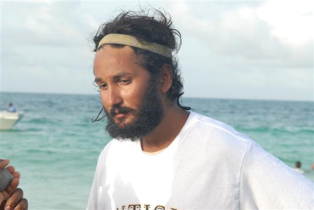
It's finally time to wrap it up. It's been a privilege to experience total isolation, total exhaustion, and living alongside fear and beauty at the same time. Its' been am amazing row and the Atlantic has been gracious enough to let me complete it alive.
Anyway, I was going to end with of something motivational. Maybe something deep and thoughtful to say but I can only think of food right now.
So I will leave you with this instead.
A penguin that walks into a bar and says, "Has my father been in here?"
"I don't know," says the bartender. "What does he look like?"
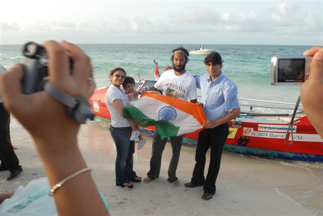
A hug for the ladies, a handshake for the gents and a thanks to everybody for their support.
B
PS. Will post from land shortly. Please email your messages to mail@bhavik.com (my normal email account), so that I can reply. Please DO NOT message my satellite phone. I will have my regular mobile number posted on here shortly.
Email: mail@bhavik.com
Confused by any of the nautical terms? Visit the Glossary: http://www.bhavik.com/crossatlantic/about_glossary.htm
Get automatic alerts each time news is updated: http://www.humanedgetech.com/expedition/bhavik/newsletter/index.php
Send me a short message via my webpage http://www.bhavik.com/crossatlantic/messages.asp

md-070613_4water2

Drinking everything thru straws

md-070613_6bucketchucket

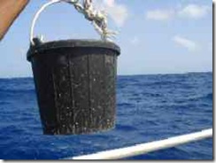
Just bucket and chuck-et!
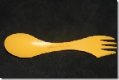
md-070613_6spoon

My spoon-fork-knife

Day 105 – POST 1: Challenges of Keeping Course, Weather Forecast

13 June, 07 – 15.30 GMT    
17.1592N,61.0980W
Distance left to Antigua (straight line): 33 Nautical Miles ( 61 km)

POSTED AT 21.00 hrs IST, 15.30 hrs GMT, 12.00 Local Time, Antigua
I rowed past my final meridian at 61W last night and all of a sudden my row seems to be ending much faster.
Its been quite a bumpy ride over the past 12 hrs. I've been rowing at a 45 degree angle to the waves all night (as opposed to following waves) trying to make progress South West. It felt like riding one of those Bajaj three wheelers on the surface of the moon and the salt sores on my rear were running for cover :)
Navigating without a motor or sail across 3000 miles ocean has been quite a daunting task. Its been a constant fight for control between the oars and the elements of the nature. Added to that Antigua is quite a difficult target to hit. Its one of the smallest islands in Caribbean measuring just 12 miles from North to South.
I'm now just 33 miles from the destination I chose 2 years ago. I'm very pleased that my choice of route (I chose a longer Southerly route as opposed to straight line or Northerly route) and zig zag adjustments for winds and currents along the way have turned out right. (...and some of you messaged me saying I was obsessing too much??? :)
The next bit of the challenge is getting into port.
The original plan was to stay South of Antigua (Around N16.3000 deg) until I was around 20 miles away and then follow a gradual gradient to make progress North West (bearing 270-290) towards English Harbour. My calculation was based on factoring in 0.5 knot north equatorial equatorial current turning NE and 10-15 knot winds from the E or SE
Unfortunately, restoring things after the capsize took up valuable time at the oars. The severe squalls and winds predominantly from the SE over the past few days have also pushed me further North West (I am now past the latitude of Antigua).
So, its been back to the drawing board. I've fixed the rudder back for one last time hopefully, so steering is a little easier. I have three options. The first, to row South West on a bearing of 220-240 till I am back on level with Antigua. Or the second option, which is to continue North West of Antigua till I am on lee of the Island and then make progress backwards in a mild headwind. Third, to drop anchor and wait until Friday, when the wind starts blowing from the East.
At present I am trying to row South West. I'm parallel to the waves but the wave height is manageable for now.
There is still some work left ahead. The other factors that complicate the landing is the wind around the islands and the tidal currents. If I miss Antigua and the headwind is more than 10 knots, it will be almost impossible to row backwards. My next options would be the islands of St Martin. Anguilla or the US Virgin Islands.
Will tell you how it goes in the next few hours...
B
WEATHER FORECAST:
OFFSHORE WATERS FORECAST FOR THE SOUTHWEST AND TROPICAL NORTH
ATLANTIC AND CARIBBEAN SEA
NWS TPC/NATIONAL HURRICANE CENTER MIAMI FL
530 AM EDT WED JUN 13 2007
OFFSHORE WATERS FORECAST FOR THE CARIBBEAN SEA AND TROPICAL N
ATLC FROM 7N TO 22N BETWEEN 55W AND 65W
AMZ087-131530-
TROPICAL N ATLC FROM 7N TO 22N BETWEEN 55W AND 65W
530 AM EDT WED JUN 13 2007
TODAY THROUGH THU NIGHT
S OF 17N E WINDS 15 TO 20 KT.
N OF 17N SE WINDS 15 KT.
FRI
S OF 17N E WINDS 15 KT. SEAS 8 FT IN E SWELL.
N OF 17N E TO SE WINDS 10 TO 15 KT.
SAT AND SUN
E WINDS 15 TO 20 KT. SEAS TO 8 FT IN E SWELL.

md-070613_1engharb

Cmap view English Harbour

md-070613_2pos

Position on Google Earth, marked by Green Arrow in the top left corner


md-070613_3birdlife

The variety of birds around the boat keeps increasing as I get closer to land

Tuesday, June 12, 2007

Day 104 – POST 2: FINAL 24 HRS , Tanker, Submarine, Dorado Jump

12 June, 07 – 10.22    
16.5283N,60.2720W
24 hr progress: 19 Nautical Miles (1 nm = 1.85 km)
Distance left to Antigua (straight line): 43.2 Nautical Miles ( 79 km)
Distance completed: 3385 NM (6262 km)
Wave height: 6-8 ft, Winds: 20 knots SE, Bearing: 270-290 degrees.


I am presently 43 miles away to the East of Antigua and hope to make landfall at English Harbour Village / Nelsons Dockyard (on the South West corner of the Island at 17.00 N, 61.48W) in the next 24 hours.
Its been a tough 72 hours and its been a fight to stay on course. My position has oscillated between North and South of Antigua and for a short period I was caught in a counter current and pushed back out to sea, loosing about 8 miles. The weather has been dull, gray and not very friendly and I've counted more than 8 rain squalls that have passed thru just in the past 24 hours.
Another tanker turned up today, without its radar on. It appeared about 500 meters off the side of the boat, just as I got out of the cabin. I had no response on the VHF either. I was too tired to panic or get angry and just counted my self lucky that it missed the boat.
Regardless of the navigational challenge, I am trying to enjoy my last 24 hours at sea as much as possible. There was quite a show last night with thunder and lighting and high winds and it's quite amazing to watch the change in sea states – from flat calm to 10 ft waves - as a squall moves over the sea from one end of the horizon to the other.
It's also my last day of watching my Dorado friends hunt for flying fish around the boat and jumping in the air to catch them. They are extremely fast and I had the rare luck of getting an incredible photo of one as it jumped right across the bow.
Amongst other diversions, the fiberglass cabin walls often happen to pick up and amply different sound waves in the water. I can usually hear the whistling of dolphins in the water. This morning I could quite clearly hear the ping of a submarine through the water. It must be why the radar alarm has been going off randomly.
Well, back to things rowing related, SE winds @ 10-15kt have been advertised for the next 24 hours. I've been pushed to the NE of Antigua by the weather and its going to be tough trying to row across the South East winds to make it into English Harbour that lies to my South West.
For the next 24 hrs or 'til landfall, news here will be updated every few hours.
Right. Back to rowing.
B
Email: mail@bhavik.com
Confused by any of the nautical terms? Visit the Glossary: http://www.bhavik.com/crossatlantic/about_glossary.htm
Get automatic alerts each time news is updated: http://www.humanedgetech.com/expedition/bhavik/newsletter/index.php
Send me a short message via my webpage http://www.bhavik.com/crossatlantic/messages.asp

md-070612_4gps 

GPS showing Flags marking my 24 hr waypoints.md-070612_5tanker

Tanker that came close this morning.

md-070612_6jump

Massive 1 meter Dorada jumping across the bow to catch a flying fish